Silver Cliff is thought to overlie a large caldera and porphyry system which increases the prospect’s potential to host a number of deposits from both precious metals to base metals. This has been demonstrated in the mineralogy and grade historically extracted from numerous underground mining operations dating back to the late 1800s and early 1900s.
Currently converting 100mm plus ozs of an historic silver resource at Silver Cliff, Colorado with a revised NI43 101 in early 2023 with significant exploration upside.
NI 43 101 Compliant Resource April 2023
- Indicated : 71 g/t Ag for 10,275M oz Silver.
- Inferred : 52 g/t Ag for 14,215M oz Silver.
Multiple exploration targets have been delineated for drilling.
• According to Quantec geoscientists, a deposit with this large size and this high of a conductivity (extremely low resistivity) is likely explained by a significant system of interconnected mineralized fractures.
• The main body of the conductive anomaly starts at a depth of ~400m and continues to a depth of ~1.5km, maybe deeper. The detectable length of the anomaly is ~1.4km in the SW-NE direction with a width of at least 700m and an open interpretation to the untested NW. This represents a total volume of over 665,000,000m3 as determined by Quantec.
• Noteworthy sulfides including chalcopyrite, molybdenite and pyrite prevailing over a continuous interval of 1100m.
• Viscount’s first drill hole in the Passiflora target seems to have most of the mineral assemblage and alteration zones that are typical of most known copper porphyry systems.
The first drill hole completed to a downhole depth of 1143m at the Passiflora has intersected continuous sulphide mineralization throughout the entire length of the hole. The drill hole which identified disseminated sulphides as well as more massive zones and abundant veins are present over an interval of 1100m. Pyrite and chalcopyrite was first identified at 465m, followed by galena at 854m and sphalerite noted tentatively at 213m but more confidently further down the hole. Magnetite was noted in trace amounts at 680m and biotite at 125m. Argillic alteration was encountered below the overburden, and around 200m it seems to change to phyllic alteration. Much of the hole after showed abundant overprinting of different types of alteration. Also, three mineralized breccia zones were identified during preliminary logging. Chalcopyrite is a brass-yellow mineral with a chemical composition of CuFeS2. It occurs in all copper porphyry deposits and is the main copper mineral in the porphyry systems.
The core is presently being logged in detail and prepared for assay. Viscount is currently in the planning stages for confirmation holes.
Jim MacKenzie CEO of Viscount stated: “The first deep drill hole at Passiflora was very consistent with the findings of the Quantec Titan survey and exceeded our expectations. As predicted, the core has abundant metallic minerals in disseminated and interlocking veins and masses that are all likely connected over an interval of 1100m. This first hole with the geologic setting, in a caldera, the associated alteration and the presence of Manto deposits, gives us the confidence of that a porphyry style deposit may be reason for the geophysical anomaly.”
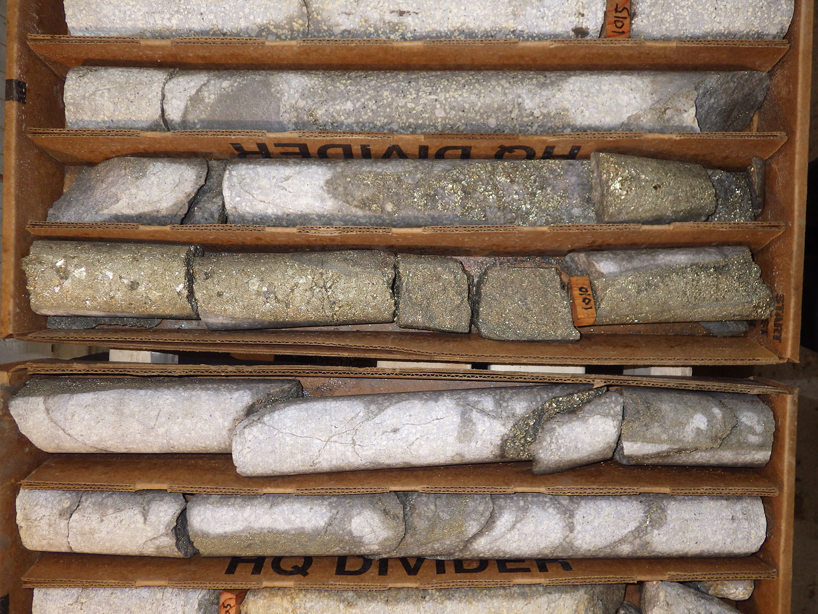
Photo 1. This photo shows both the vein pyrite. These are the metallic thin bands occur at several places in the core and are steep angles to the core. The more massive pyrite occurs on both sides of the wooden marker 1010 (306m). The core below the marker 1015 shows porphyritic texture; fine grey ground mass with white larger minerals.
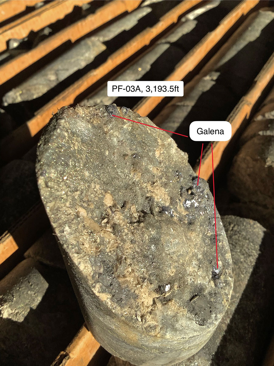
Photo 2. This piece of core exhibits three separate areas of galena, the major lead sulfide. They are bright metallic luster and lead-grey in color. In porphyry copper deposits they often present as an additional economic important metal to the copper.
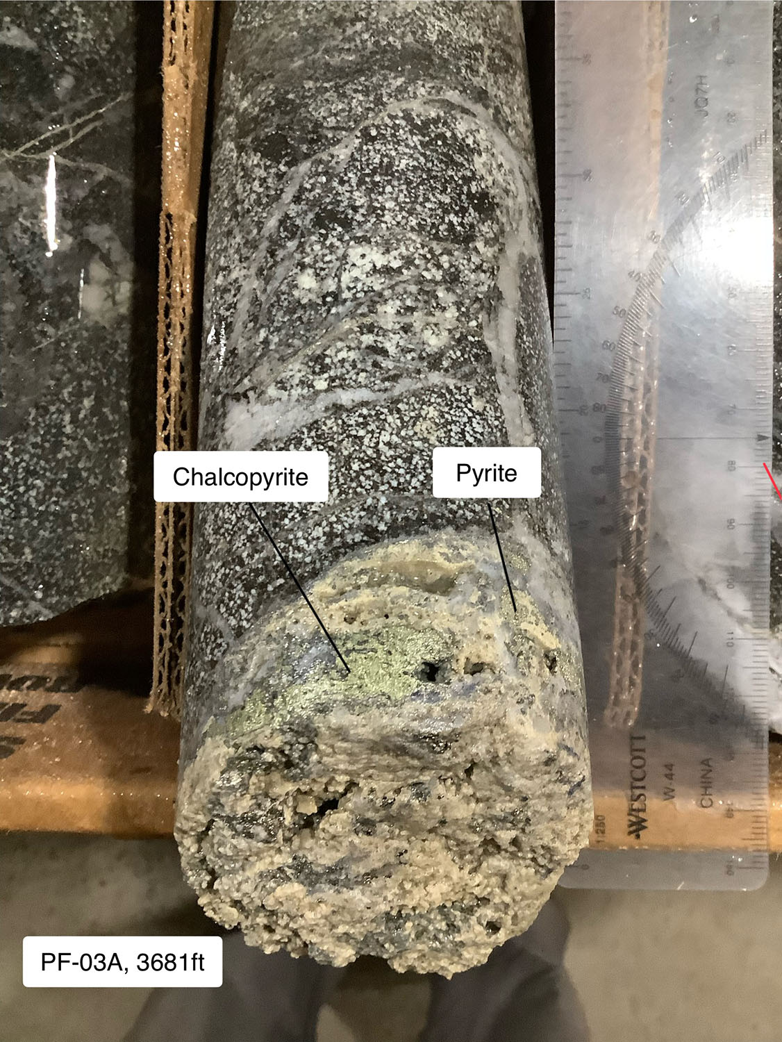
Photo 3. The chalcopyrite can be seen as being more brassy in color to pyrite. When disseminated or in small veins, the metallic minerals are hard to tell apart. On the cross section of the core small blebs of pyrite can be seen, and are easier to tell apart from the chalcopyrite than the pyrite with the arrow.
Figure 1, below, is a cross section of through line L1E which depicts a view of the massive, low resistivity anomaly described by Quantec. As shown, the bowl-shaped anomaly extends ~1400m (~4590 ft) across the center of the caldera, and at least 1500m (~4920 ft) deep, maybe deeper, depending upon the accuracy of resistivity detection below the conductive body.
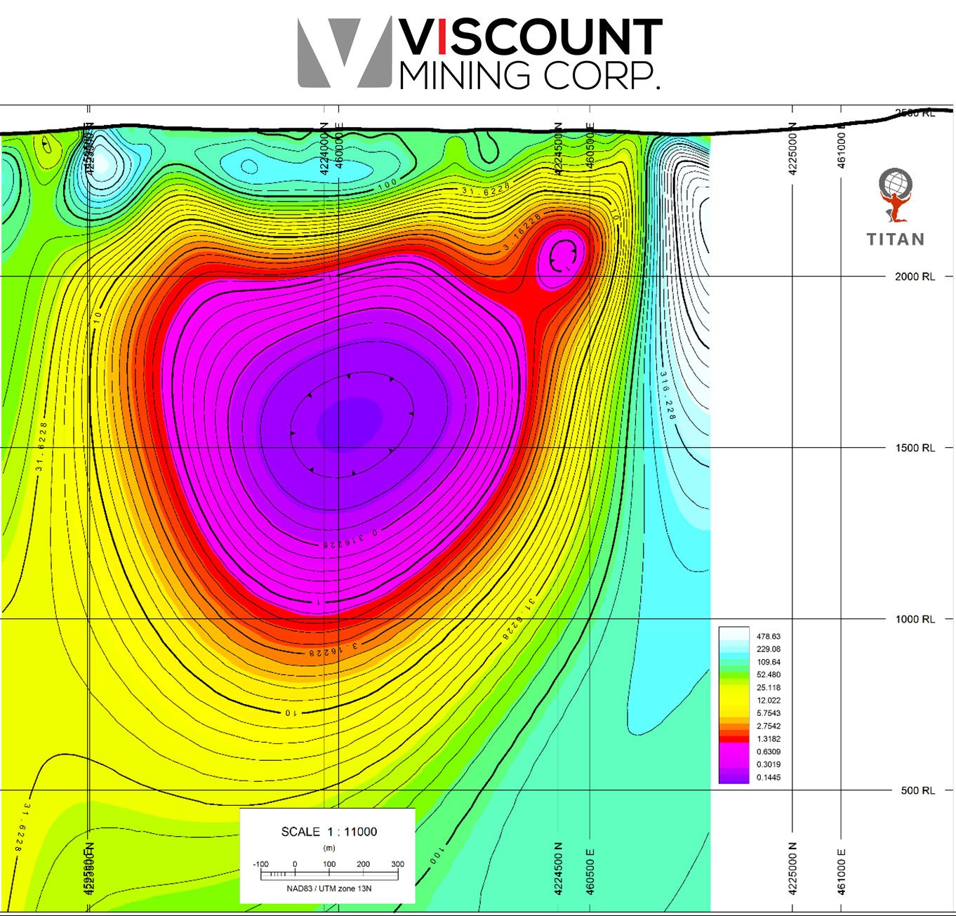
Figure 1. A cross section through line L1E showing resistivity (in ohm-m) to a depth of ~2400
With the volcanic history of the region as a caldera makes it completely reasonable to assume that the Passiflora target could be a porphyry at depth. This caldera is one of at least ten eruptive centers of the Central Colorado Volcanic Field (CCVF). Four of these ten have been further classified as silicic eruptive centers, of which the Silver Cliff caldera is one (McIntosh and Chapin, 2004). Another member of this classification is Cripple Creek Mine, a highly profitable, still active deposit located ~70km NNE of the Passiflora. The ore being mined at Cripple Creek is primarily from diatremes (volcanic breccia pipes), which overlie sulfide-altered, porphyritic igneous intrusions. Based on Viscount’s first hole a similar system of sulfide-hosting igneous intrusions also exist at depth in the Passiflora target.”
Qualified Persons
The scientific and technical information contained in this news release has been reviewed and approved by Harald Hoegberg PG, an independent consulting geologist who is a “Qualified Person” (QP) as such term is defined under National Instrument 43-101 – Standards of Disclosure for Mineral Projects (“NI 43-101”).
Silver Cliff hosts a large economical silver resource with several mineralized deposits and significant exploration upside.
The primary deposit, Kate Silver Resource (KSR), hosts a historical (non-compliant) estimate of 50M oz Silver by Tenneco Minerals in 1990. (not 43101 compliant)
Tenneco Minerals made the decision based on the accumulated data and a feasibility study with silver at $5.00 USD an ounce to construct at that time a $35,000,000 USD milling operation for open pit mining of silver reserves at Silver Cliff. Known historical silver grades range from below detection to a high of 2,125 g/t (68 o/t) Ag over 13.4 metres. Known historical gold grades range from below detection to a high of 9.06 g/t (0.29 o/t) Au over 1.2 metres. Shortly thereafter, their parent company was sold and the new owners decided to divest their mineral interests and the decision was reversed in 1991.
Approximately 1.2 kilometers NNW of the Kate Silver Resource lies a geochemically distinct, yet likely hydrothermally related deposit historically referred to as the Passiflora Deposit. According to a mining report by R. A. Rivera (1983), nearly 18,000 tons of silver valuing over $500,000 was extracted from the Herman-Passiflora Mine between 1916 and 1948. A major shaft collapse in 1945 left notable ore unrecovered (Joseph M. Bradley, 1948). A reserve calculation by CoCa Resources for the Passiflora target released in 1983 indicated at least 64M oz. silver at 51.9 G/T (not NI 43-101 compliant) stating, “a sustained advance in silver price to the $15 level would make the deposit quite attractive (R. A. Rivera, 1983).” With the price of silver now well over this mark, Viscount has begun to further develop an understanding of the Passiflora target.
Silver Cliff Property Geology
The fall of 2016 drilling shows that the silver mineralization (blue grey) is hosted predominantly by a gently-dipping unit of highly altered rhyolite tuff that was deposited during volcanic activity in the Silver Cliff caldera.The Kate Silver Resource (the “KSR”) at this juncture appears to be the result of extensive alteration by hot hydrothermal silver/lead/zinc-bearing fluids that ascended up along deep seated faults and related fractures. These rhyolite tuff units can be found over a large lateral extent are susceptible to extensive alteration by metal rich hydrothermal solutions and maybe the greatest promise for the KSR in the other deeper unexplored stacked horizons. These may be found associated with high grade epithermal veins that could underlie the KSR.
The geology shows that the silver mineralization (blue-grey mineralization) is hosted predominantly by a gently-dipping, silicified carbonate reef that formed during a volcanic hiatus. The Kate Silver Resource at this juncture appears to be the result of simple carbonate replacement by silica-rich, silver/lead/zinc-bearing fluids adjacent to interpreted deep seated epithermal veins. These carbonate rock systems replaced by silicification-associated resources are commonly found over large lateral extents and the greatest promise for the Kate Silver Resource may eventually lie in undiscovered stacked horizons, in combination with high-grade epithermal veins that may underlie the Kate Silver Resource.
At the Passiflora the level of increased alteration displayed, as well as the assumed volcanic history of the region as a caldera, make it completely plausible to believe that the Passiflora target could be a porphyry at depth. There are evidence that point to a possible porphyry system at depth The increase in the intensity of the phyllic alteration towards the South West as well as the increase in metals concentrations. Silvercliff caldera are one of at least ten eruptive centers of the central Colorado volcanic field. It has been classified as part of the silicic centers that includes Cripple creek McIntosh and Chapin NMBMMR Bulletin 160) where Mo, Au porphyry has been found at depth. The ore being mined are from diatremes (volcanic breccia pipes) within the Cripple Creek volcanic field. Diatremes may also exist at depth in the Passiflora target. Viscount management are currently considering a telluro-magnetic Survey to more precisely delineating targets at depth.
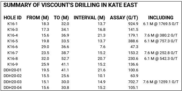
SILVER CLIFF 2016 & 2017 DRILL RESULTS
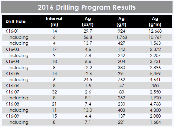
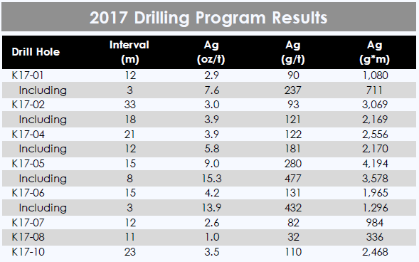
Bonanza-grade drill intercepts found near surface (< 15m)
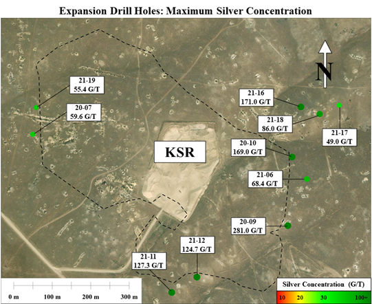
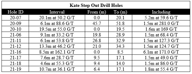
The focus of Viscount Mining’s third phase of drilling was to test the outer boundaries of the Kate Silver Resource (KSR) as defined in Dr. Gilles Arseneau’s NI43-101 in 2018. Five of these nine drill holes lie to the northeast of the previous KSR and should significantly expand the silver resource in this direction. Specifically, drill hole 21-16, which lies approximately 120 meters outside of the previous mineralized body definition, revealed 88.8 g/t silver over 16.2 meters including 8.5 meters testing at 162.1 G/T silver. In all, these five step out drill holes in the northeast Kate cover a surface area of over 12,500 square meters and successfully expand the footprint of mineralization outside of the KSR. All holes contain sections testing above the current cut-off grade (~20 G/T). In addition to northeast expansion, the drilling also revealed slight expansion to the south. Drill holes 21-11 and 21-12 both contain sections testing over 124 G/T and are positioned up to 25 meters outside of the KSR boundary. The report titled Mineral Resource Estimate for the Silver Cliff Property, Custer County, Colorado, USA dated April 15, 2018 was prepared by Dr. Gilles Arseneau, Ph.D., P. Geo of Arseneau Consulting Services (“ACS”) in accordance with the Canadian Institute of Mining, Metallurgy and Petroleum (“CIM”) Definition Standards incorporated by reference in National Instrument 43-101 (“NI 43-101”) for its Silver Cliff property in Colorado.
Using historic drilling data and recent soil sample results, drill hole locations were selected outside of the KSR boundary, primarily to the northeast and south. Viscount is pleased to announce that the third phase step out drill holes exhibited results above cut-off grades. As shown in the map below, this now accounts for nine drill holes drilled outside of the KSR.
ROCK CHIP RESULTS 2013- 2021
Highlighted results include:
• 28 samples assaying over 100 g/t silver
• 18 samples assaying over 200 g/t silver
• 4 samples assaying over 550 g/t silver including 1330 g/t and 737 g/t in the northern Kate area and 692 g/t and 560 g/t in the south Passiflora area.
Phase 3 of Viscount Mining’s Silver Cliff drill program consisting of 13 holes over 881 meters has recently concluded and all of the core samples have been shipped and are currently being assayed. As a supplemental part of Viscount’s phase 3 drilling program, 50 surface rock chip samples were collected around the Kate Deposit, Passiflora and surrounding areas. Most of these samples were gathered from century-year-old, shallow mining pits which are found scattered throughout the Silver Cliff region. A map depicting silver concentration of each of these 124 surface samples including 74 local rock chip samples collected back in 2013 is shown below.
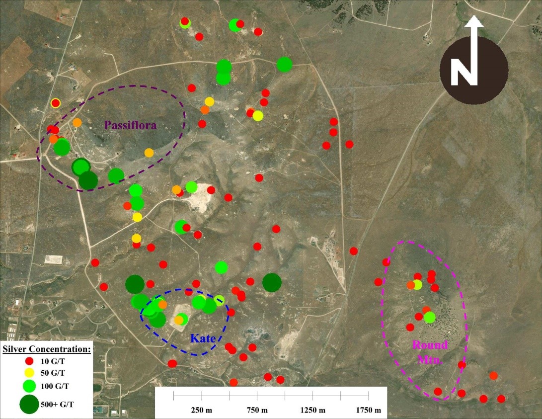
Twenty eight (28) of these rock chip samples collected at the surface tested over 100 g/t silver, with the highest testing sample assayed 1330 g/t silver. The presence of such high-grade silver deposits being revealed at the surface by shallow, abandoned pits, shows high promise for an eventual open pit mine. Many of these higher testing samples were collected from two locations: the southwest Passiflora and the northern area of the Kate Deposit and extension.
In the northern area of the Kate Deposit, 15 surface rock chip samples assayed between 71 and 1330 g/t silver, well above the current economic cut-off grade. Seven (7) of these high-grade rock chip samples, including the two highest testing (737 and 1330 G/T), on land outside of the current extent of the ore body as defined by Dr. Gilles Arseneau in 2018. The report titled Mineral Resource Estimate for the Silver Cliff Property, Custer County, Colorado, USA dated April 15, 2018 was prepared by Dr. Gilles Arseneau, Ph.D., P. Geo of Arseneau Consulting Services (“ACS”) in accordance with the Canadian Institute of Mining, Metallurgy and Petroleum (“CIM”) Definition Standards incorporated by reference in National Instrument 43-101 (“NI 43-101”) for its Silver Cliff property in Colorado.
-

- 924 g/t Ag over 14 meters included 1768 g/t Ag over 6 meters

-

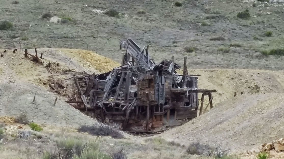
- Old Mining Site
-
- Old Mining Site

-
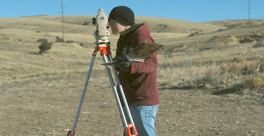
- Silver Cliff Surveyor
-
- Old Kate Claim Boundary With Discover Information Carved

-
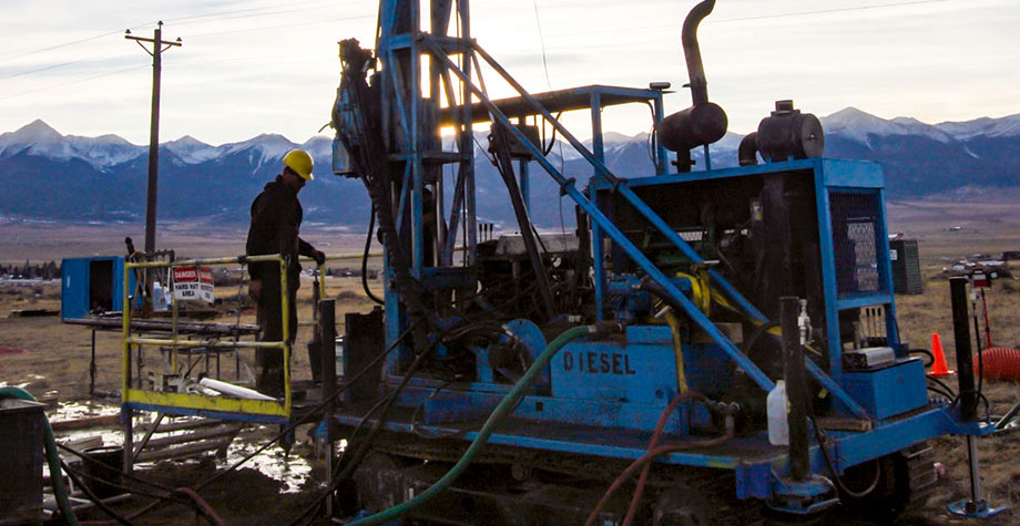
- Drill Rig

-

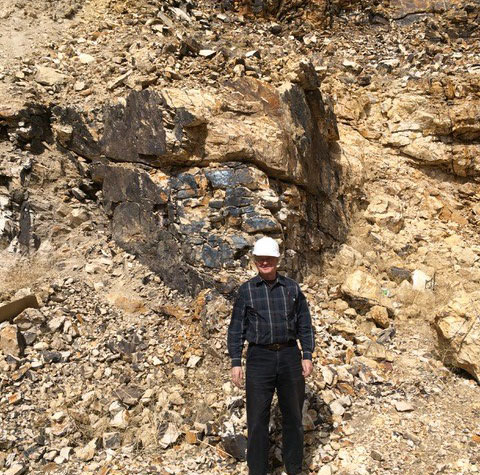
- Exposed Silver Vein At Silver Cliff
-
- Exposed Silver Vein At Silver Cliff

-

- Cutting Core

-
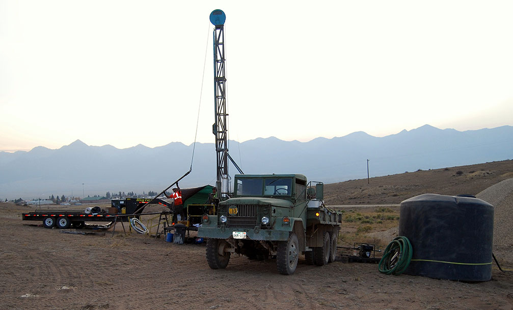
- Drill Rig
-

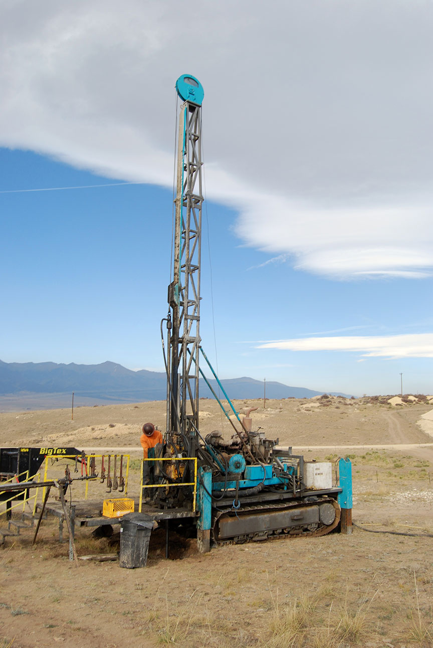
- Atlas Copco Drill
-
- Atlas Copco Drill
Stay In Touch