Cherry Creek Nevada Highlights
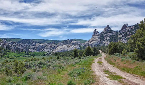
• Viscount Mining holds a 100% interest in the Cherry Creek Project located approximately 90 miles south of Wells, in White Pine County Nevada comprising of 9,000 acres, including more than 20 past producing silver and gold mines with a majority on patented property.
• This is the first time most of Cherry Creek’s past producing mines have been assembled under one ownership group.
• This land holding includes the three largest past producing Silver mines – the Exchequer/ New Century Mine, Teacup and the prolific Star Mine which were in production until the 1920’s.
• Twelve RC drill holes were completed in the fall of 2015 in the historic silver mining area encompassing the former Ticup, Doctor’s Cut and Jacob’s Cut mines
• Hole depths ranged from 79.3m (260 ft.) to 329.3m (1,080 ft.), with a total of 2,224.1m (7,297 ft.) completed.
• A total of 1551 samples were submitted to ALS Global for assay and multi‐element analysis.
• Samples consisted of 1394 unique drill cutting intervals each representing a minimum of 1.5m (4 ft. 11 in) and 157 reference samples.
Moderate to high grade silver mineralization was intercepted in many of the holes. Notable drill intercepts and silver assays results include:
• Hole CC001: 9.1 m at 52.6 g/t Ag, maximum silver assay value of 99.4 g/t
• Hole CC002: 27.5 m at 52.0 g/t Ag, maximum silver assay value of 167 g/t
• Hole CC006: 12.2 m at 117.6 g/t Ag, maximum silver assay value of 506 g/t
• Hole CC008: 100.5 m at 7.4 g/t Ag, maximum silver assay value of 64 g/t
• Hole CC010: 15.2 m at 54.2 g/t Ag, maximum silver assay value of 133 g/t
• Hole CC011: 30.5 m at 50.0 g/t Ag, maximum silver assay value of 247 g/t
• Hole CC045: 125 m at 25.0 g/t Ag, 1.6 g/t Au
• Hole CC046: 174 m at 320 g/t Ag, 1.7 g/t Au

Silver Cliff Colorado Highlights
Drill Hole K16-01 assayed 1,778.5 g/t (57.2 oz/t) silver over a 20-ft. (6.1m) interval within a 50 ft. (15.2m) mineralized intersection averaging 837.4 g/t (26.9 oz/t).
• The Company’s flagship asset is the 100% owned Silver Cliff, which hosts a high-grade silver resource with several mineralized deposits and significant exploration upside.
• NI 43 101 Current resources, effective April 15, 2018 are
– Indicated Resources of 2.1Mt grading 84 g/t Ag for 5.6M oz Ag
– Inferred Resources of 3.2Mt grading 70 g/t Ag for 7.1M oz Ag
Multiple exploration targets have been delineated for drilling
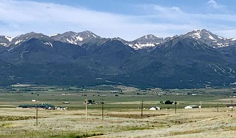
• The Property consists of 96 lode claims where high grade silver, gold and base metal production came from numerous mines during the period 1878 to 1894. It is located 44 miles WSW of Pueblo, Colorado, and has year-around access by paved road. The property underwent substantial exploration between 1967 and 1984. The major explorers were Freeport, Hecla, Homestake, Moly Corp, Coca Mines and Tenneco Minerals.
• The Silver Cliff Property is interpreted to encompass a large caldera and porphyry system which offers potential to host a number of deposits from both precious metals to base metals. This has been demonstrated in the mineralogy and grade historically extracted from numerous underground mining operations dating back to the late 1800s and early 1900s.
• Tenneco Minerals at the Kate Deposit between 1987 and 1990, completed a feasibility study for open pit mining of silver and announced plans to construct a $35,000,000 milling operation at Silver Cliff. Shortly thereafter, the parent company, Tenneco was sold and the new owners decided to divest their mineral interests and the decision was reversed in 1991.
• Silver Cliff geological structure appears quite simple. Dips are to the east-southeast at 2° to 5°. Faulting is not obvious on the surface and a contour map of the surface of the lower obsidian suggest that no faults with more than 50 feet of displacement occur within the area of the Kate mineralization. Examination of PQ wireline core drilled in 1989 for a metallurgical sample, indicate; however, that faults with minor displacement are numerous.
• In 2016 and 2017, a total of 1,367m were drilled across 19 holes with results returning bonanza-type grades as high as 1,768 g/t Ag.
All cores were assayed at ALS Canada Ltd., at their laboratories in Reno, Nevada, and Vancouver, BC. Highlights were from drill hole K16-01 which assayed 1,778.5 g/t (57.2 oz/t) silver over a 20-ft. (6.1m) interval within a 50 ft. (15.2m) mineralized intersection averaging 837.4 g/t (26.9 oz/t). Deposit is near surface, open along strike and at depth and is likely amenable to open-pit mining.

Stay In Touch