Cherry Creek consists of 219 unpatented and 9 patented claims as well as mill rights. Cherry Creek includes more than 20 past producing mines.
Viscount’s flagship property is focused on exploratory mining operations in the immediate vicinity of an area commonly known as the Cherry Creek Project, located approximately 50 miles north of the town of Ely, in White Pine County, Nevada.
Viscount has acquired all rights by purchasing from owners the patented claims which, allow Viscount the exclusive rights to prospect and explore for, mine by underground or open pit methods, mill, prepare for market, store, sell and dispose of all ores and minerals on or under the described properties.
Viscount has also acquired over 20 past silver / gold / tungsten producing mines including Blue Bird, Chance Mine, Filmore, Last Chance, Exchequer/ New Century Mine, Ticup and Motherlode mines.
Geologically, most of the mines are located in numerous Precambrian to Triassic aged quartzites, shales, limestones and dolomites as vein deposits, mostly in the Prospect Mountain Quartzite and the Cambrian Carbonate Formations. One of our project’s goals is focused on exploring the extensions of major veins in the district.
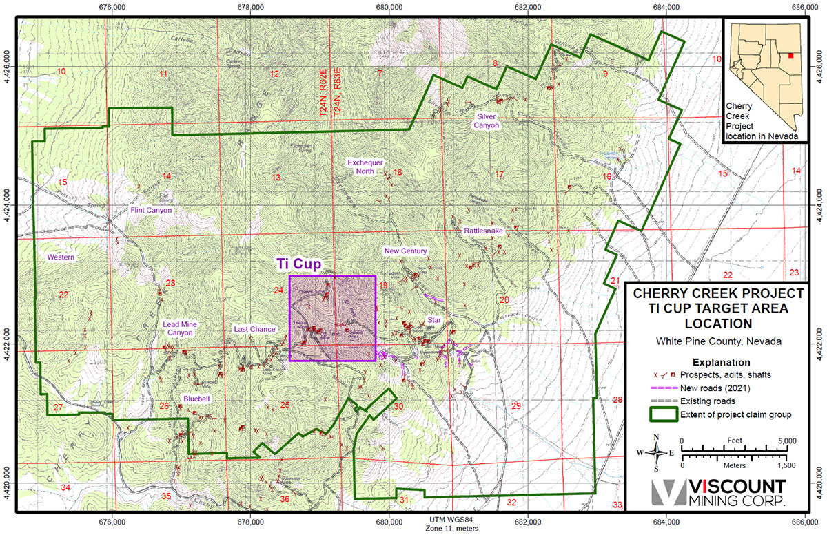
The three past important mines located in the Cherry Creek project are the Ticup, New Century / Exchequer and Star Mines. Because these three large past producing mines and the numerous smaller mine can indicate a possible hidden large mineral system related to a buried acid intrusive pluton Viscount staked all of the prospective ground between and adjacent to the old mines and prospects. This is the first time the all of the ground is under one company.
CHERRY CREEK OVERVIEW
- Intrusive-related Silver, Gold and Tungsten mineralization with multiple alteration styles over
a widespread area in early Paleozoic marine sediments and basal quartzite - Mineralization styles vary from CRD, minor skarn, decalcification and jasperoid
formation and quartz vein / quartz breccia - Deposit styles may include Carlin-like mineralization in limestone and deeper
seated Gold, Copper and Molybdenum porphyry. - 578 un-patented and 17 patented claims in White Pine County Nevada,
Cherry Creek Mountains. A horst-range bounded by deep basins on NW and SE
and steep relief (1950 to 3100 m elevation). - 100-year historic mining district with distinct Silver, Gold and Tungsten booms lasting
as late as the 1960’s - 2021 – Claim expansion 2250 ha added, soil grid expansion,
rock chip and geologic mapping expanded, IP, airborne and ground mag. - 2022 –Drilling on defined targets and follow-up drilling
Flint Spring Canyon
The recognition that Flint Spring Canyon may be analogous to Newmont’s Long Canyon deposit was first made during the field investigation for the Snowden NI43-101 report in 2012. Snowdon Mining Industry Consultants identified structural, mineralogical and stratigraphic parallels with the sediment-hosted deposit being mined by Newmont at Long Canyon. In 2019, a thesis was completed by David Freedman on the Cherry Creek District under the direction of Dr. Ressel – Former Chief Geo. of Newmont North America and Associate Professor Geology at University of Nevada Reno. The thesis documents a large, long-lived hydrothermal system showing an abundance of hydrothermal-induced mineralization of nearly 8 km2 of favorable structures and stratigraphy.
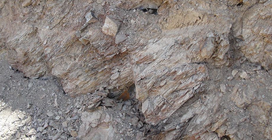
The 2015 mapping done at Flint Spring Canyon found the area to be much more complexly faulted than previously indicated on the Adair 1961 geologic base map. The mapping program found that east‐west orientated faults and fractures, which are important ore controlling structures at the Ticup and Star Mines, also occur in the area. The Flint Canyon area contains highly dissected fault blocks of the Dunderberg Shale with the underlying Marjum Limestone and overlying Notch Peak Limestone. The Pogonip Formation overlies the Notch Peak and both units are important host rocks for Long Canyon type gold mineralization in eastern Nevada.
Viscount’s Flint Canyon area exhibits alteration and mineralization characteristic of Long Canyon-type gold deposits. The exploration program in 2016 was started at Flint Spring Canyon soil sampling combined with detailed geologic mapping and drilling.
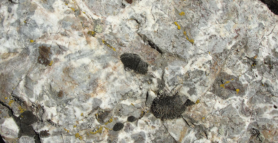
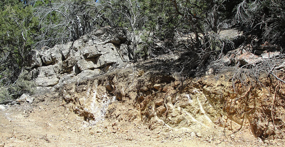
Jasperoid occurrences in Nevada are extremely significant, and mineralized jasperoid outcrops are common throughout the Flint Spring Canyon area. They occur principally along the base of the Dunderberg Shale but other outcrops are found along Pogonip‐Notch Peak contact. Many major gold discoveries have been made based on the presence of outcropping, weakly mineralized jasperoid hosted in and along bedding contacts of carbonate rocks. At Flint Canyon, jasperoid is found in the same carbonate rocks that are prolific host rocks at Newmont Mining’s nearby Long Canyon gold deposit.
The jasperoid beds, interpreted as west dipping tabular features, occur along the base of the Dunderberg Shale and within the Pogonip group limestone. The Dunderberg Shale is generally recessive and is exposed mainly along the outcropping contacts with more competent rocks. The Dunderberg appears to be moderately altered throughout its distribution, and at Flint Spring Canyon it experienced widespread and significant alteration by hydrothermal fluids. The underlying Marjum Limestone is usually competent and unaltered, while the overlying Pogonip exhibits variable alteration.
The Flint Spring Canyon jasperoid and carbonate rock chip samples are highly anomalous in gold mineralization.
Exchequer/New Century Mines and Star/Grey Eagle Mines
Recent mapping and sampling by the project geologists have verified the anomalous gold and silver in this area, from the Star Mine up to and past the Grey Eagle vein which is subparallel to the Exchequer vein. Since the Star structure strikes northwest, it may extend to the Exchequer vein. Therefore, the potential target area extends from the Star Mine to the Exchequer structure. The drill programs will test the possibility of a major deep seated gold-silver and base metals deposit in this general mineralized area. This could become a significant new area with economic grade mineralization. With the possibility of connecting the three past producing mines underground, could mean a significant cost saving in mining if an economic grade deposit is discovered.
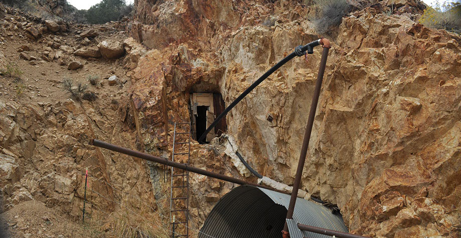
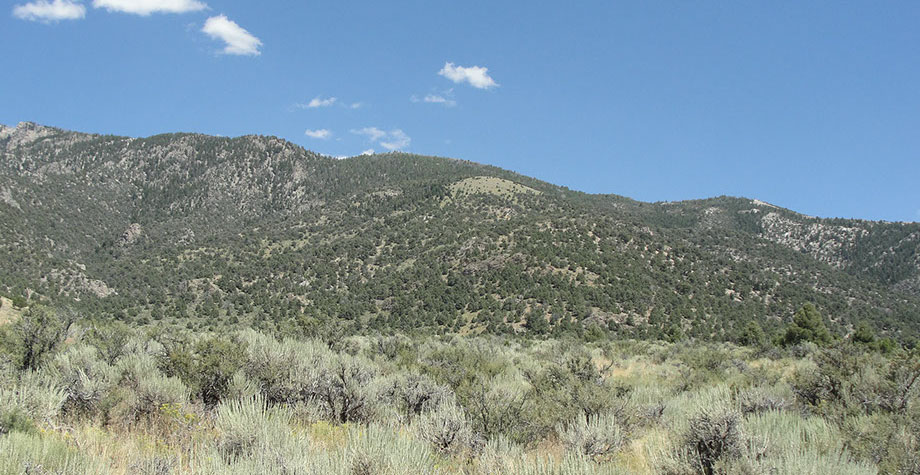
Numerous exploration and mining activities were conducted in the past at Cherry Creek up to 1964. These activities were primarily focused on silver/gold with associated base metals and tungsten. The Cherry Creek district contains patented land ownership from most of the older mines in the area. Numerous archival mine reports and history have been identified for the Cherry Creek District in NBMG Bulletin 85. Numerous mines exist in the district and exploited silver, gold with base metals and tungsten in the late 19th and early 20th century. A photo of the Cherry Creek area is located in Figure 1.
Cherry Creek
Here at one time was the largest town in White Pine County, part of the Cherry Creek Mining District. Cherry Creek’s main years of gold and silver production were between 1872 and 1883. At the peak of its prosperity, the town had an estimated population of 6,000.
Ownership History
A company of volunteer soldiers under a Captain Tober discovered a gold-silver bearing quartz vein in the area at Egan Canyon, approximately 5 miles south of the subject claims, possibly as early as 1861. In 1863, some early mining started in the Gold (Egan) Canyon. The Gilligan mine was developed in 1863, the production from which was processed in the first mill in Nevada constructed in 1864. Silver was and still is the principal economic metal in the area; however gold associated with the silver has also provided significant economic returns. By 1866 both a 5-stamp and a 10-stamp mill were operating. In 1869 a 20-stamp mill was built at the head of Egan Canyon to treat the silver ores, there were now by this time three mills operating in the area.
The first mine in the Cherry Creek area was the Ticup, discovered in 1872. This initial discovery brought an immediate rush of prospectors to the area. Following on from the Ticup were the Star, Exchequer and Grey Eagle mines. The town of Cherry Creek, located at the mouth of Cherry Creek Canyon was formed in 1873 with an early population in the range of 400 by this time seven mines were operating. This initial production era stopped in 1875 with a general downturn in the US economy.
The next period of significant mining production began in 1880. At its peak, around 1882, the town had a transient population of 6000 and 1800 permanent residents. New claims were developed at the Ticup and Exchequer mines and by 1874 there were a reported twenty mines of various production rates in operation. In that year a major fire led to the closure of the Star Mine.
The initial production focus was silver chloride, evidenced at the surface by muddy yellow-grey stains. This type of silver ore could be smelted directly. Later siliceous and sulphide ores became more evident and more difficult to treat by direct smelting. A combination of low silver prices, the higher cost of mining and recovering silver from the deeper sulphide ores, and a continuation of low economic growth in the US and Europe led, by end 1885, to the closure of the mines in the district.
In 1905 a return to production was experienced in the Cherry Creek area. The Ticup, Exchequer, and Star Mines were reopened and production began at two new mines, the National and the New Century. An extension of the Northern Nevada Railway through Cherry Creek was opened in 1906; however production from the area again faded by 1910 with some of the mines only operating at a very small scale. The Penns Star Mining Company built a flotation mill to process the sulphide ores that continued to process ores through to 1921.
In 1927, the Nevada Standard Mining Company was formed and purchased forty one claims that encompassed most of the districts mining claims and operating companies. The company continued to actively mine the Star (the most productive mine in the area), Gray Eagle, Imperial and Exchequer mines. The mines by then had workings of more than 40,000 feet. The Company worked the mines through to 1940 when production from the area finally ceased.
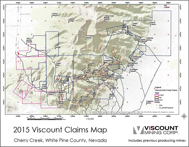
Figure 1: Claim Map showing patented and un-patented claims
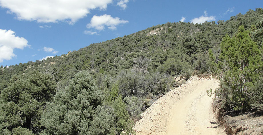
The Cherry Creek project area can be reached by heading south of Wells, Nevada on highway 93 and then west on a local county road for 8 miles. Most of the federal land in the project area is governed by the Bureau of Land Management (BLM) in the Cherry Creek mine district. The claim areas are accessed from the town of Cherry Creek to the northwest via a well maintained unpaved road up the Exchequer Valley to the Exchequer mine area and from there by foot. Access to lower topographical elevations may be gained for the purposes of exploration on a year round basis. For air service, the closest major airport is in Salt Lake City, Utah located approximately 110 miles to the north east.
Climate
The climate in the region of Cherry Creek is semi-arid with monthly precipitation less than 3 cm. Snowfalls of 18 cm or more can occur during the winter months, particularly at the higher elevations.
Daily temperatures range in the summer between highs of 21 and 32°C during the day and between lows of 2 and 10°C during the night time. Winter temperatures range during the day between -4 and 4°C and at night time between -12 and -4°C with potentially lower temperatures at higher elevations.
Topography, elevation and vegetation
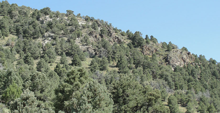
The regional topography is mountainous with the mineral claims located in the Cherry Creek Range that runs generally north-south for approximately 80 km. The highest point in the range is an unnamed peak, 3,188 meters located just south of the border between the White Pine and Elko Counties. The mineral claims in which Viscount have interests are located along the western and eastern slopes of the Cherry Creek Range at a surface elevation of between 2,130 and 2,440 masl (meters above sea level) and are located to the west of the Steptoe Valley that has an elevation of about 1,830 masl. The entrance to the Exchequer Mine is at an elevation of approximately 2,130 masl.
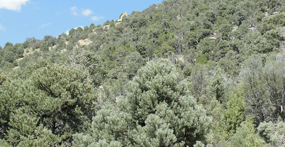
The abandoned town of Cherry Creek is located in the Steptoe Valley. The vegetation sparsely covering the slopes of the Cherry Creek Range is generally stunted juniper and fir. At higher elevations the juniper gives away to Pinyon and other pines followed by mountain mahogany and open stands of alpine balsam, bristlecone and cattail pine. The natural vegetation remains in all areas other than some small areas developed for mining operations.
The Cherry Creek Project Area lays within the Basin and Range Tectonic Province of the western US. The Basin and Range Province consists of a series of North to NNE trending mountain ranges separated by broad alluvial basins. The mountain ranges are structurally high areas; the basins are structurally low areas. Complex fault movements resulting from deep seated crustal extension formed the basins and ranges. The crustal extension process began between 30 and 20 million years ago, and is still on going to this day.
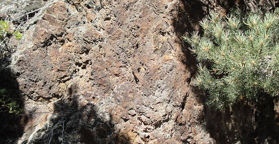
The area contains every geologic system from the Precambrian to the late Triassic with shales, quartzites, limestones, and dolomites. The entire area is tilted on a west dipping homocline partially covered by latter rhyolite tuffs and flows. These rock units are cut by three sets of faults and intruded by two smaller igneous plutons (32.1 m.y.) with numerous north west and north east trending dikes, some of are up to 1,200 feet wide and 4 miles in length. Most of the favorable ore is found along structural contacts with the Prospect Mountain Quartzite and major lithologic units and faults.
The general structural trend of the north part of the Cherry Creek Mining District is that of a west dipping monocline. The oldest structures in the area are the bedding plane faults. They are all hosted in the Cambrian sections, and have metal deposits associated with them. Three major right lateral faults cut across the range. Two of these, the Black Metal Fault and the Exchequer Fault are in the prospect area, and both strike to the northeast. They displace the bedding plane faults, but not the intrusives, thus being bracketed in terms of possible age. The Black Metal Fault is the more northerly of the two, and is thought to have the greatest displacement (1,220 m). It is persistent, and in the field it is marked by quartz veins silicification and brecciation.
The Exchequer fault is the host to the Exchequer vein, described previously. Just west of the mine, the vein is hosted in quartzite and splits into several segments. Additional northeasterly faults exist in the district, and some are associated with metal deposition.
East –West striking faults also exist and are thought to be part of the general development of the northeasterly trending systems. They are not as common, but significant as they host the Star vein.
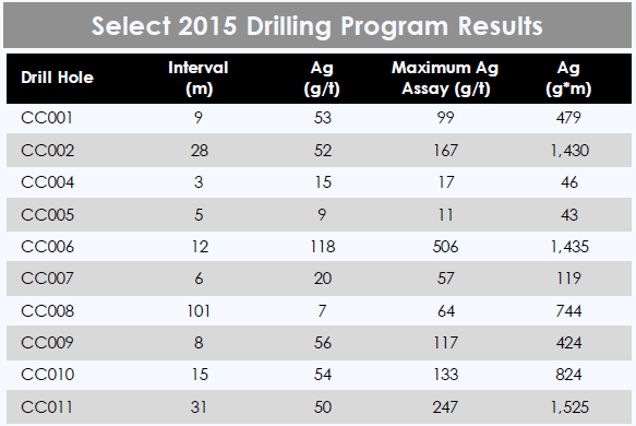
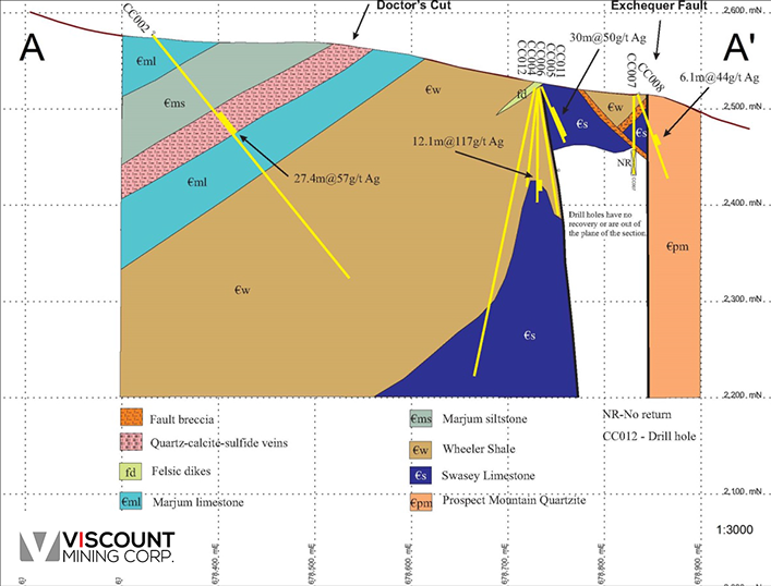
CHERRY CREEK 2015 DRILL RESULTS
Section A Overlay with 2015 Drill Results
2022 Drill Results
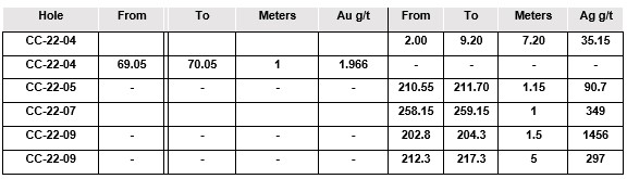
Centerra’s drilling identified three vertically stacked Carbonate Replacement Deposit (CRD) type features and mineralized zones at the Ti-Cup target. (Please refer to the figure below). These are large scale brecciation features in the limestone that host high-grade silver veins and lower grade silver mineralization that borders and overlaps the three zones. Base metal values encountered in these zones included lead to 10001 ppm, zinc to 10001 ppm, Cu to 4579.8 ppm and W to 101 ppm. These minerals generally occur in narrow veins and replacement zones from 0.75 to 4 meters in thickness.
Ti-Cup CRD Horizons
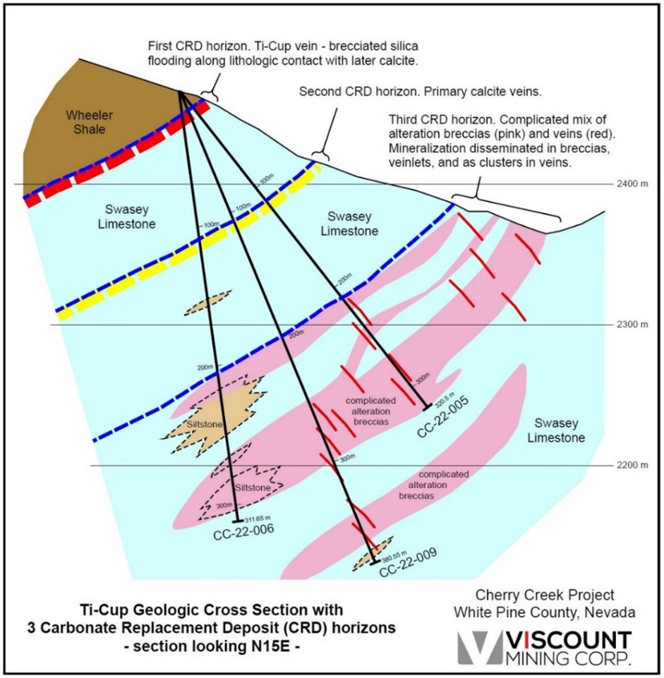
Drilling revealed several hundred meters of brecciation and anomalous silver mineralization which is approaching economic grades at depth. The surface projection of the breccias and mineralization projects to the northeast and away from the historic producing mine in an area that has not been historically explored. The potential for a high-grade silver bonanza CRD exists at the prospect and in the silver soil anomaly. Grab sample anomalies continue for more than a kilometer to the northeast into the higher terrain.
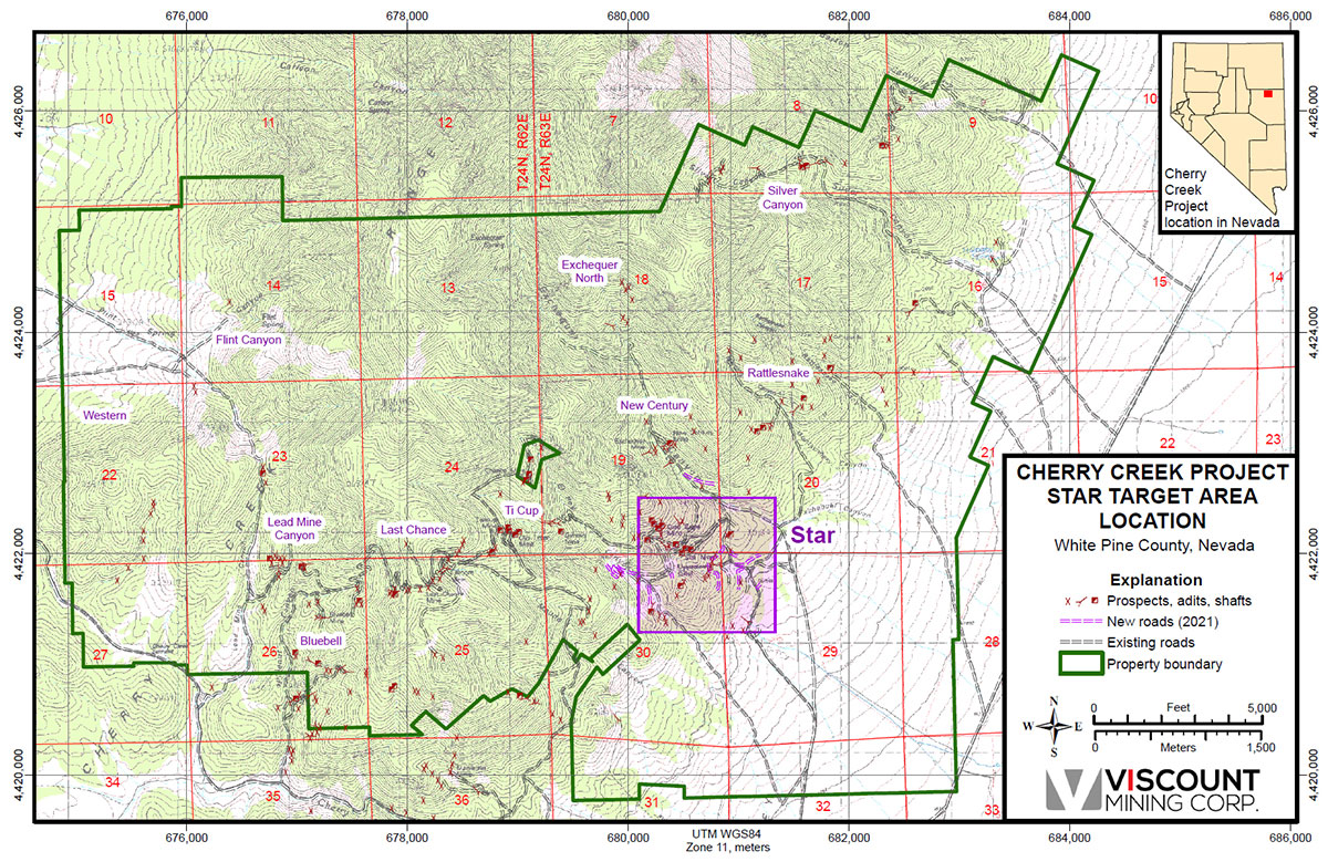
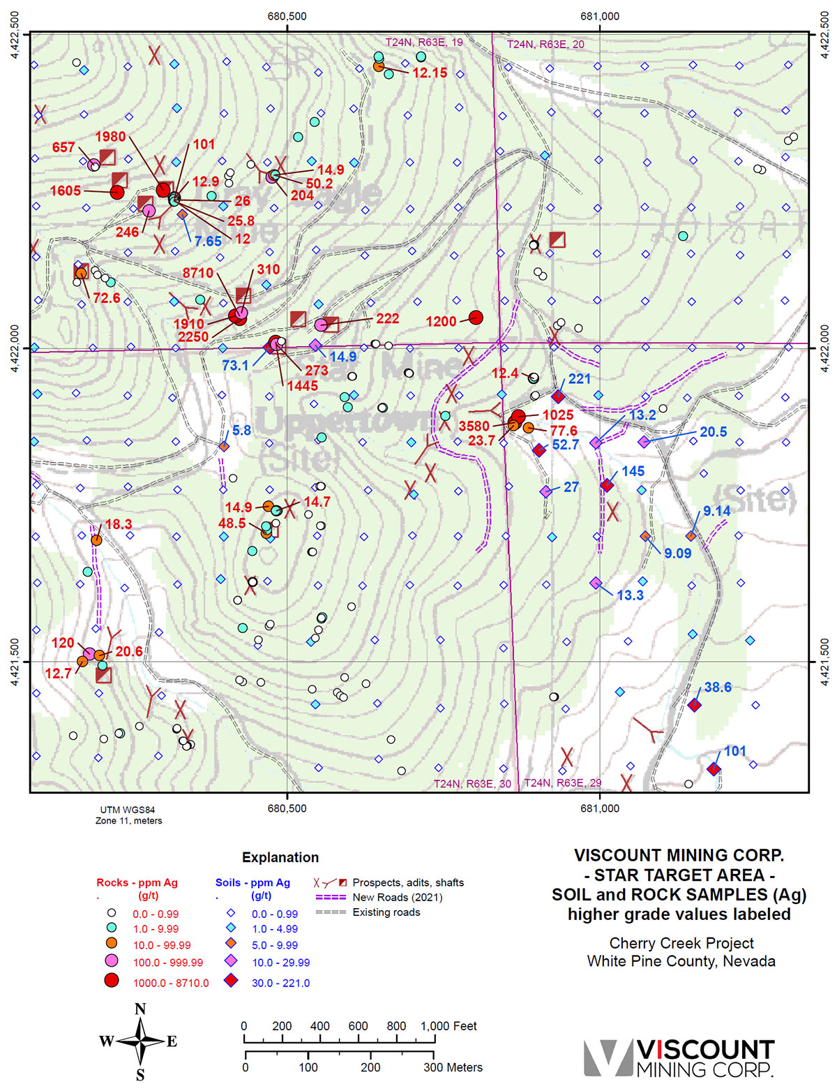
Star Target Area Location
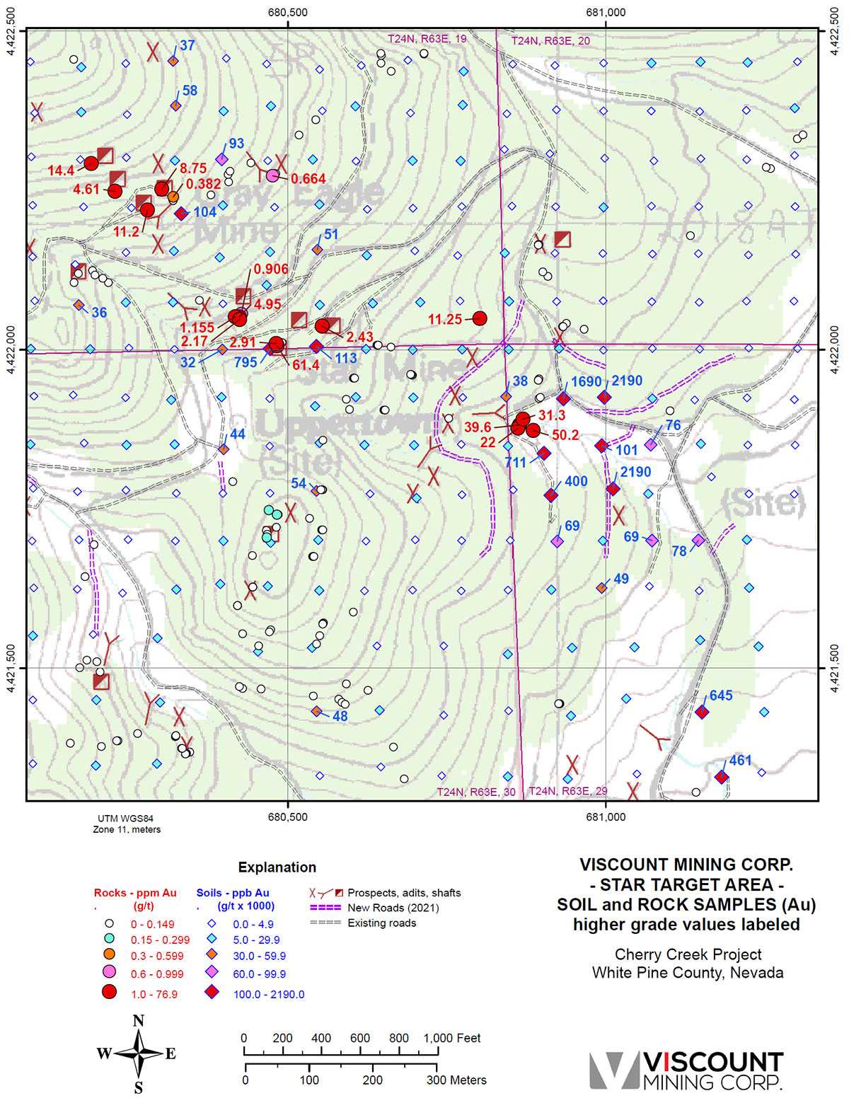
The Star Vein system is comprised of the subparallel South Star Vein and the North Star Vein emplaced about 9 m (30 ft) apart. Both veins have a production history, with the South Star Vein having the greatest production. The larger South Star Vein ranged in width from 0.3 to 2.1 m, with an average gold grade of 7.8 g/t gold and average silver grade of 622 g/t silver; with 8% lead and 8% zinc. Some very rich ore shoots averaged 24,880 g/t silver. The mine produced over $6,000,000 of silver and gold up to the time of F.C. Schrader’s report in 1931. The vein system has been traced over 670m and extends over 260m at depth. The best ore shoot is 1m thick and 300m long. With the above average grades, for the rest of the 370m, Schrader estimated the Star mine has the potential to host an additional 4 million ounces of silver and 500, 000 oz of gold. Schrader also stated a reported grade of 8% Pb and 8% Zn in the lower levels with an estimated base metal reserves of 35,000,000lbs (15,000t) of both lead and zinc. (Source: University of Nevada Bulletin 14a, Nevada State Bureau of Mines and Mackay School of Mines. Author: F. C. Schrader geologist of the U.S. Geological Survey 1931.) All of Schrader ‘s estimates are deemed to be historical and not 43-101 compliant.
Gold Values – Star Target Area
Silver Values – Star Target Area
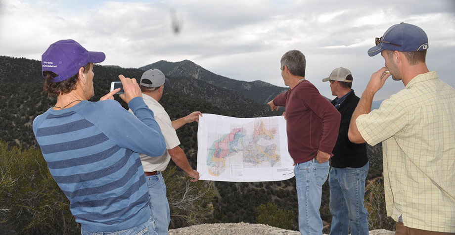
The Target Area Location Map below shows the eleven target areas that have been the subject of focused prospecting, geochemical sampling and geophysics work this year. It also shows the outline of our enlarged claim position. All the targets will be discussed in upcoming news releases. This release highlights the TiCup Target Area.
The TiCup was a major silver producer in the Cherry Creek Mining District. The deposits occurred as high-grade lenticular chutes and replacements within the vein and a thrust fault. This mine was noted for having ore shoots of bonanza grade ore. For example, in 1874 when the shaft was at a depth of 73m and had only 137m of development work the 2.5ft vein at the bottom of the shaft assayed $234 per ton when the price of silver was $0.90 oz. The average grade of the silver being mined in 1874 was 420-470 oz/t with the highest shipment reporting 4200 oz/t. (Source: University of Nevada Bulletin 14a, Nevada State Bureau of Mines and Mackay School of Mines. Author: F. C. Schrader geologist of the U.S. Geological Survey 1931). All of Schrader’s estimates are deemed to be historical and not 43-101 compliant.
The TiCup vein strikes northeast with a moderate dip to the west. It occurs within a thrust fault that separates massive limestone from an overlying shale. The vein has been traced for 3.5 miles and to a depth of 1,100 feet. The vein is truncated on the north by the Exchequer Fault which is likely the source of the mineralizing fluids. The vein is also bounded on the south by a post-mineral high-angle fault. Fred Anderson, the mine manager at the time of Tognani’s report, reported the mineralization to be open below the TiCup shaft. (Source: TiCup Mining Corp. Internal Report. Author: Michael A. Tognoni, TiCup Mining Corp. mining engineer, 1985). The estimates are deemed to be historical and not 43-101 compliant.
Centerra’s drilling identified three vertically stacked Carbonate Replacement Deposit (CRD) type features and mineralized zones at the Ti-Cup target. (Please refer to the figure below). These are large scale brecciation features in the limestone that host high-grade silver veins and lower grade silver mineralization that borders and overlaps the three zones. Base metal values encountered in these zones included lead to 10001 ppm, zinc to 10001 ppm, Cu to 4579.8 ppm and W to 101 ppm. These minerals generally occur in narrow veins and replacement zones from 0.75 to 4 meters in thickness.
Ti-Cup CRD Horizons
Drilling revealed several hundred meters of brecciation and anomalous silver mineralization which is approaching economic grades at depth. The surface projection of the breccias and mineralization projects to the northeast and away from the historic producing mine in an area that has not been historically explored. The potential for a high-grade silver bonanza CRD exists at the prospect and in the silver soil anomaly. Grab sample anomalies continue for more than a kilometer to the northeast into the higher terrain.
With these recently identified permissive hydrothermal breccias in the Ti-Cup mine area, all of which overlie an Eocene age intrusive rock thought to be a mineralization driver in the district; the potential for finding silver and base metal CRD deposits is considered very good. CRD deposits are high temperature deposits and can form large orebodies that extend over long distances.
Mark Abrams, Viscount VP of Exploration stated: “The geological setting at Cherry Creek has many similarities to the “Upper and Lower Hilltop Zones” at the Ruby Hill gold mine recently reported on by i80 Gold Corp. (TSX:IAU) in their December 19, 2022 news release. The Ruby Hill mine is located approximately 50 miles west of the Cherry Creek project. There are many other examples of CRD deposits in the region, including those associated with the Bingham Canyon mining complex in Utah. CRD deposits are an important source of silver and base metals in many jurisdictions.”
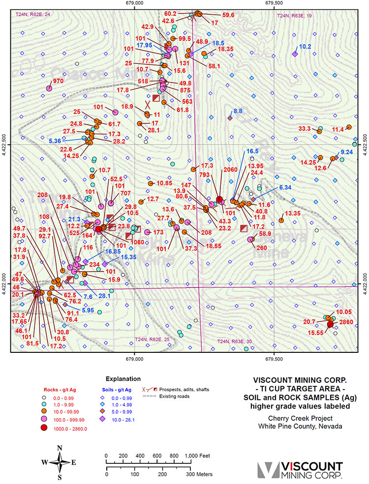
Additional exploration opportunities exist both at depth below the Ticup workings and further to the southwest along the Ticup and adjacent Fillmore Veins. Our recent sampling indicates numerous silver values in rock samples. These areas lie on patented mining claims controlled by Viscount Mining. The TiCup target area is 376.49 acres or 152.36 hectares.
Two hundred and six rock samples and two hundred sixty-eight soil samples were collected in the TiCup target area and analyzed for gold, silver, and pathfinder elements. The maximum rock sample for gold was 17.35 g/t. Three rock samples ran greater than or equal to 1.0 g/t gold. The high soil sample for gold 399 ppb, while six samples ran greater than or equal to 30 ppb gold.
The maximum rock sample silver for silver was 2,860 g/t, while the maximum silver value in soils was 28.1 g/t. Forty-six rock samples ran greater than or equal 50 g/t silver, with ten rock samples assaying greater than or equal to 500 g/t; while two soil samples ran greater than or equal to 20 ppm silver. The TiCup target is clearly a silver dominant target. The silver geochemical values are presented on the TiCup Target soil and rock sample map below:
Silver Values – TiCup Target Area
Geological mapping and geochemical sampling for the season has ended with December snows in the higher country, and the field crew has taken a holiday break. So far Centerra has taken 1005 rock chip samples and 1207 soil samples. They have collected 82.6-line km of IP, 8 square km of ground magnetics and 850-line km of airborne magnetics. In addition, they completed a small Tromino survey (passive seismic tool for mapping stratigraphy and structure under pediment cover). First pass mapping and sampling have been completed over large portions of the property.
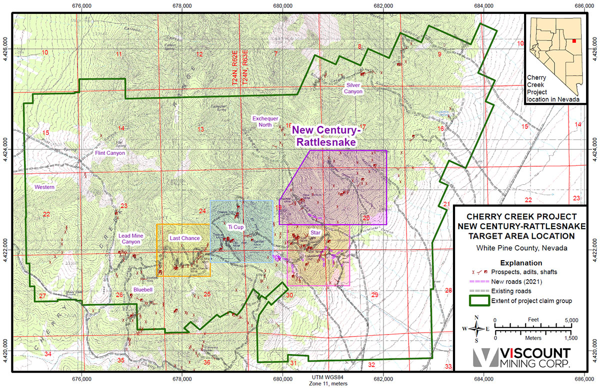
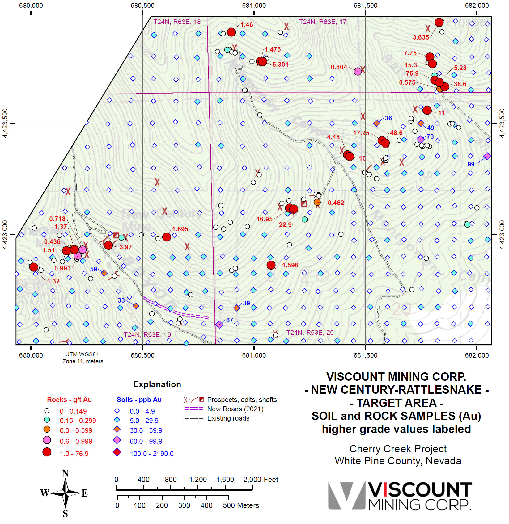
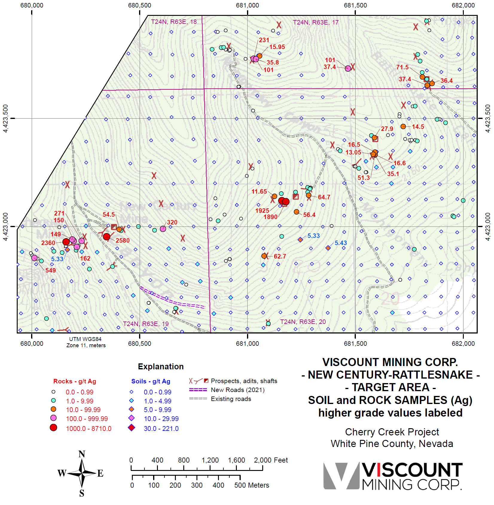
The New Century – Rattlesnake target is comprised of the New Century (Imperial) and Exchequer mines on the southwest side of the target area in Exchequer Canyon, and a large cluster of un-named gold prospects on the northeast side of the target area in Rattlesnake Canyon. In between these areas are numerous precious metals prospects. These mines and prospects lie in faults and veins proximal to the Exchequer master fault. The Exchequer fault strikes in a northeast direction running from the Golden Butte/Limousine Butte gold mine area on its southwest end a few miles west of the Cherry Creek property, to the cluster of high-grade gold prospects in Rattlesnake Canyon at its northeast extent.
Mineralization at the New Century – Rattlesnake target and the past producing mines is generally localized along east-northeast near vertical quartz veins hosted in argillite, limestone, shale, and quartzite. Parallel structures are common. Additionally, many of the faults had been intruded by quartz monzonite porphyry. These are the areas where the mineralized veins form.
The strike length of the mineralized zone on the New Century-Rattlesnake target area is 2100 meters and the target area encompasses 703.75 acres or 284.8 hectares.
One hundred fifty-one rock samples and three hundred eighty-one soil samples were collected in the New Century-Rattlesnake target area and analyzed for gold, silver, and pathfinder elements. The maximum rock sample for gold is 76.9 g/t. It was initially reported our news release dated October 20, 2020. This sample represents the highest gold value in a rock-chip sample on the Cherry Creek project. A significant amount of additional sampling in 2021 has greatly expanded the Rattlesnake Canyon portion of this target area. Twenty-two rock samples ran greater than or equal to 1 g/t gold. Fifteen rock samples ran greater than or equal to 2 g/t. Nine rock samples ran greater than or equal to10 g/t. Four of the rock samples ran greater than or equal to 20 g/t. The high soil sample for gold was 99 ppb. These are significant gold values that occur in clusters over a long strike length, leading us to believe in the excellent potential of this target.
Gold Values – New Century-Rattlesnake Target Area
Silver Values – New Century-Rattlesnake Target Area
-

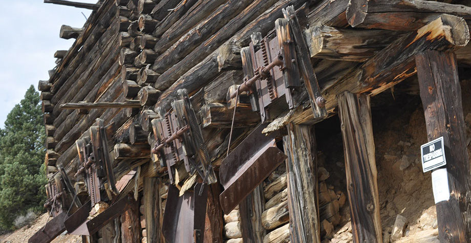
- Previously Producing Grey Eagle Mine
-
- Previously Producing Grey Eagle Mine
-
- Previous Mine Structure
-
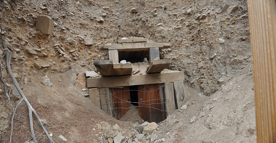
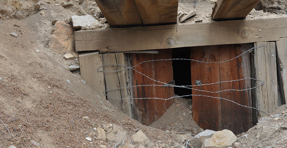
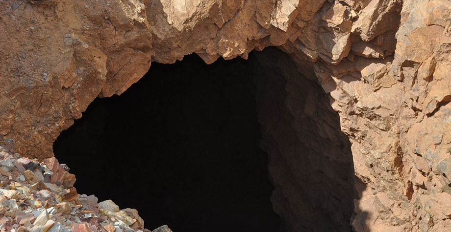
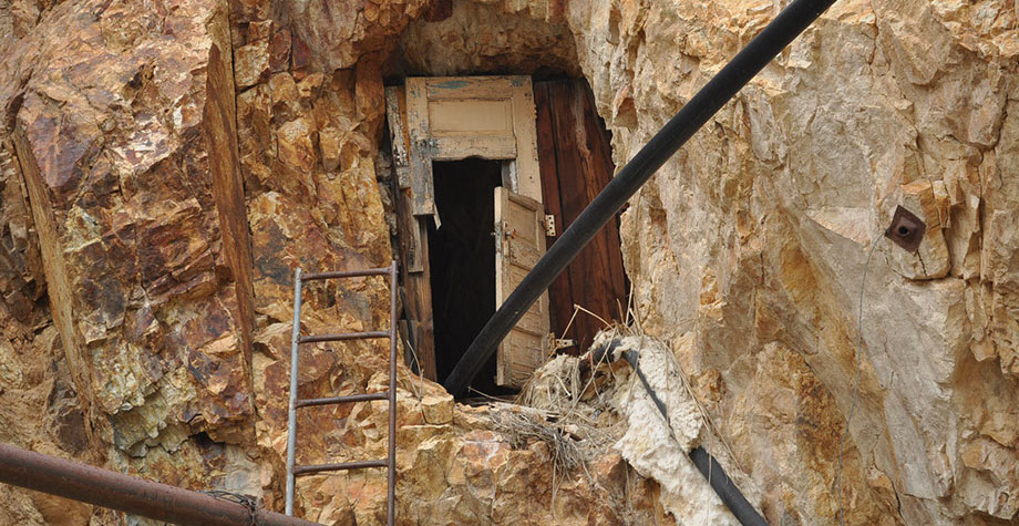
- Previous Producing Mine Entrance
-
- Base Camp

-
- Hillside

-
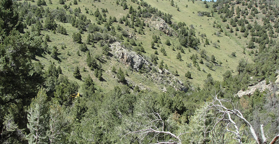
- Overlooking Star Mine
-
- Previously Producing Exchequer Mine
-
- Previously Producing Exchequer Mine
-

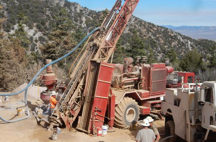
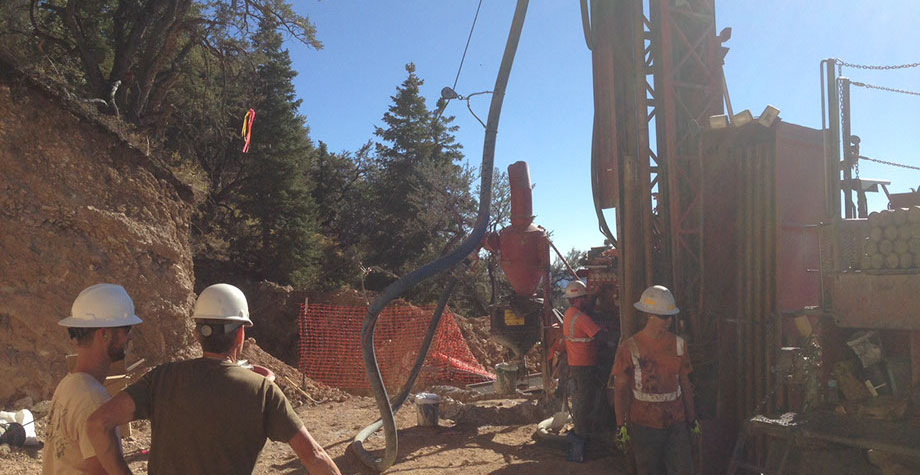
- Drill Rig at Flint Canyon
-
- Drill Rig at Flint Canyon
-
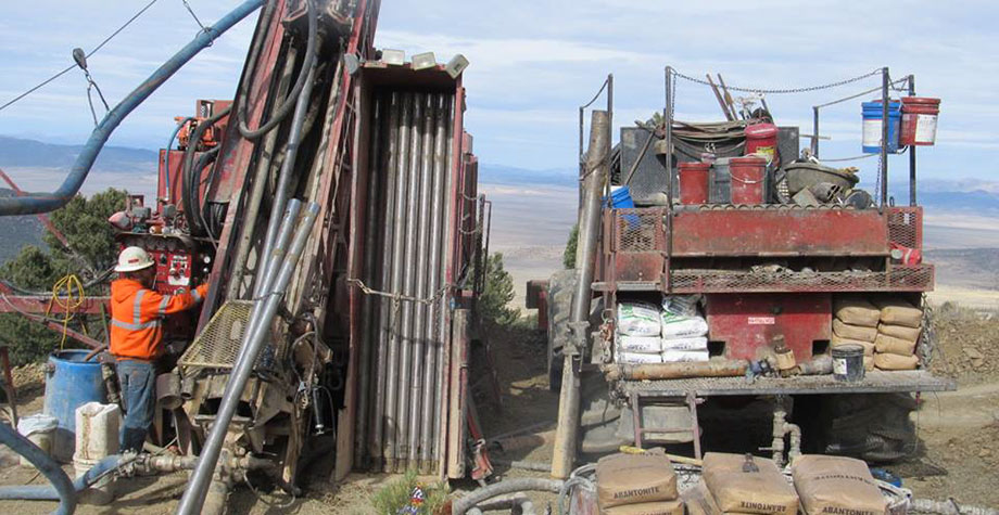
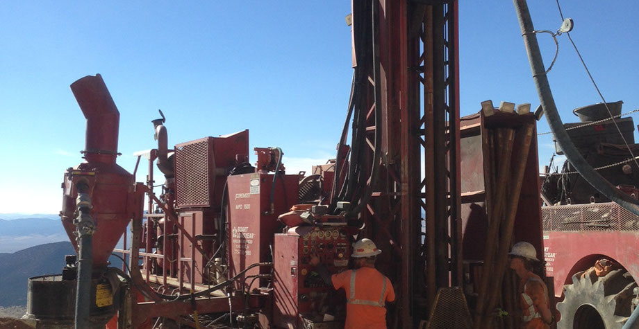
- Boart Longyear At Flint Canyon

-
- Boart Longyear At Flint Canyon
-
- Boart Longyear At Flint Canyon
-
- Dunderburg Shale
-
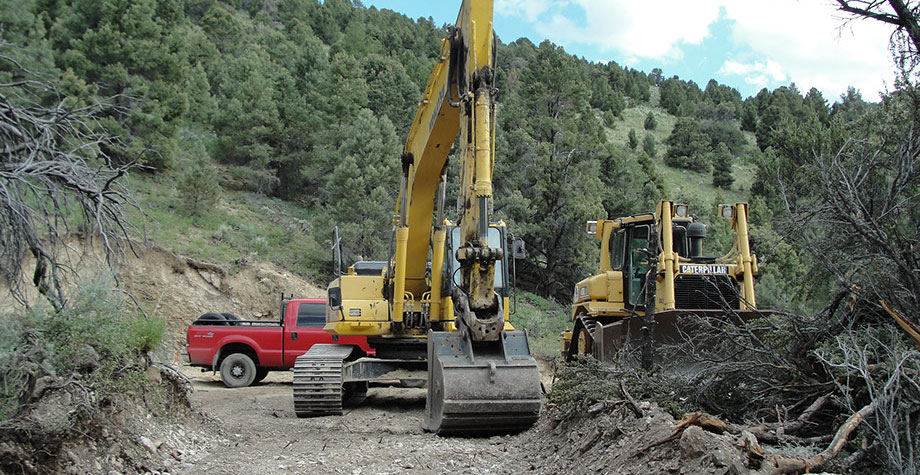
- Excavator Working A Pad
-
- Excavator Working A Pad

-
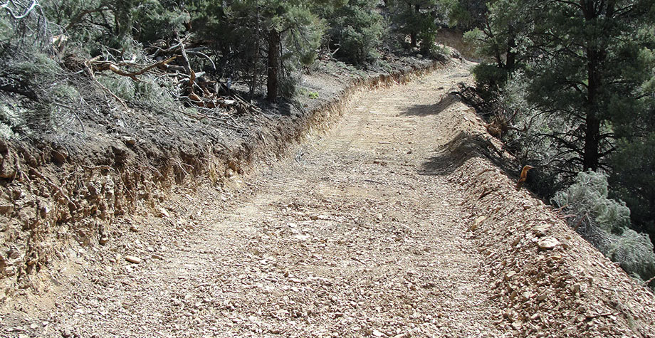
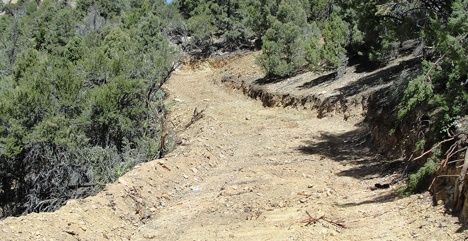
- Fault In Road Between Pad 1 And Pad 2
-
- Flint Canyon Area Looking East
-
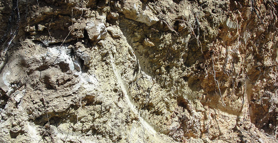
- Jasperoid In And Around Lower Drill Road

-
- Jasperoid In And Around Lower Drill Road
-
- Jasperoid In And Around Lower Drill Road
-
- Jasperoid In And Around Lower Drill Road
-
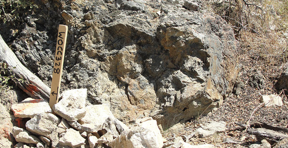
- Jasperoid On Lower Drill Road Area

-
- New Road Looking Toward Pad 2 And Excavator
-
- New Road Looking Toward Pad
-
- Pioneered Road Between Pad 1 And Pad 2
-
- Pioneered Road Between Pad 1 And Pad 2
-
- Road Going Uphill From Pad 1
-
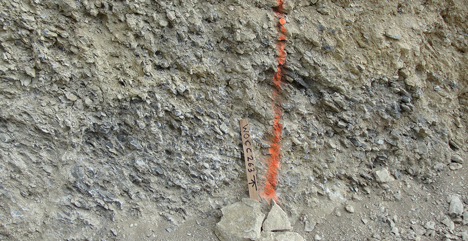
- Sample Site Between Pad 1 And Pad 2
-
- Sample Site South Of Pad 2 In Jasperoid
-
- View From Pad 1 To Where Pad 2 Was Built
Stay In Touch